In recent years, the market for certified GIS professionals has expanded as the value that certification can bring to an organization is increasing. The certainty that a company or institution has in knowing that when it hires a professional officially certified by ESRI, he will have the necessary knowledge to produce the analysis and GIS products that they are looking for. That is certainly a decisive factor in hiring today.
A professional certification exam and the certification itself can be a proof that the knowledge and proficiency are there. This is nothing different from the largest IT companies in the world (CISCO, Microsoft, Google ) certifying professionals for the industry.
With this in mind, ESRI is offering professional certification tests in various categories, for a very interesting price, only $ 250 for core plus $ 150 for specialist modules, and during the pandemic, you can take the test so online . Know more:
ESRI Technical Certifications: The modules available
The technical certification exams Esri validate the experience in three areas:
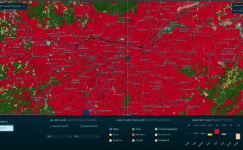
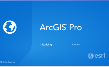
- Desktop : Aimed at experienced users using ArcGIS PRO and ArcGIS online
- Enterprise: Aimed at professionals who implement, configure and support advanced spatial data systems for companies
- Expert: For those more specific users such as Python and Java developers, AGOL administration, Analysts, etc. To take the specialist exams, you must first pass one of the core exams

Certifications are offered at three levels: entry, associate and professional.
Desktop certification
Desktop certification exams are undoubtedly the most sought after and common. They measure a wide range of skills and knowledge related to the use of ArcGIS Desktop applications, including ArcGIS Pro, in conjunction with other components of the platform.

The ArcGIS Desktop Entry exam tests the candidate’s experience in applying ArcGIS concepts and processes to workflows. Qualified candidates must demonstrate an understanding of the basic concepts of ArcGIS, including recognition of the ArcGIS platform at an early level. Applicants must perform basic tasks of mapping and viewing, editing and managing geodatabase files. Qualified candidates must have less than two years of applied experience and must be proficient in the best practices and the use of Esri’s ArcGIS technologies.
The test for ArcGIS Desktop Entry EADE 19-001
The test consists of 80 multiple choice questions, in English, in which the candidate will have 1 hour and 45 minutes to answer.
All the details and the content of the exams at this level (EADE 19-001) are in this PDF, click here to download
– PDF with content for EADA 19-001 (Associate)
– PDF with content for EADP 19-001 (Professional)
The other exams
Learn more about each exam available and see what you want to do. To take the specialist exams, you must first pass one of the core exams:
- ArcGIS Desktop Associate
- ArcGIS Desktop Professional
- Enterprise Admin Professional
- Enterprise geodata management professional
- ArcGIS Online Administration (Specialist, $ 150, Content )
- ArcGIS API for Python (Specialist, $ 150)
- Others
How to prepare for the test?
ESRI itself makes the training material available for free through the company’s training catalog in the link below . The duration of the training session is two hours. You only need a free global ESRI account to access it ( you can create it here ).
Link: Preparing for the ESRI certification test
How and where to take the exam?
After selecting the exam that is right for you, reviewing the Contract and Program Policies, purchase the voucher and schedule the exam . You can choose from more than 5,000 test centers worldwide or use OnVue and take your exam online. Vouchers can be applied to any exam and must be used within 12 months from the date of purchase. Click here to choose and schedule your exam.


Interesting: See list of jobs and salaries for certified GIS analysts in the USA
Good luck and success in the exams!